File:HVDC Crossover North-Dakota.jpg
Jump to navigation
Jump to search
Size of this preview: 800 × 600 pixels. Other resolutions: 320 × 240 pixels | 640 × 480 pixels | 1,024 × 768 pixels | 1,280 × 960 pixels | 2,592 × 1,944 pixels.
Original file (2,592 × 1,944 pixels, file size: 3.23 MB, MIME type: image/jpeg)
Summary
| Description |
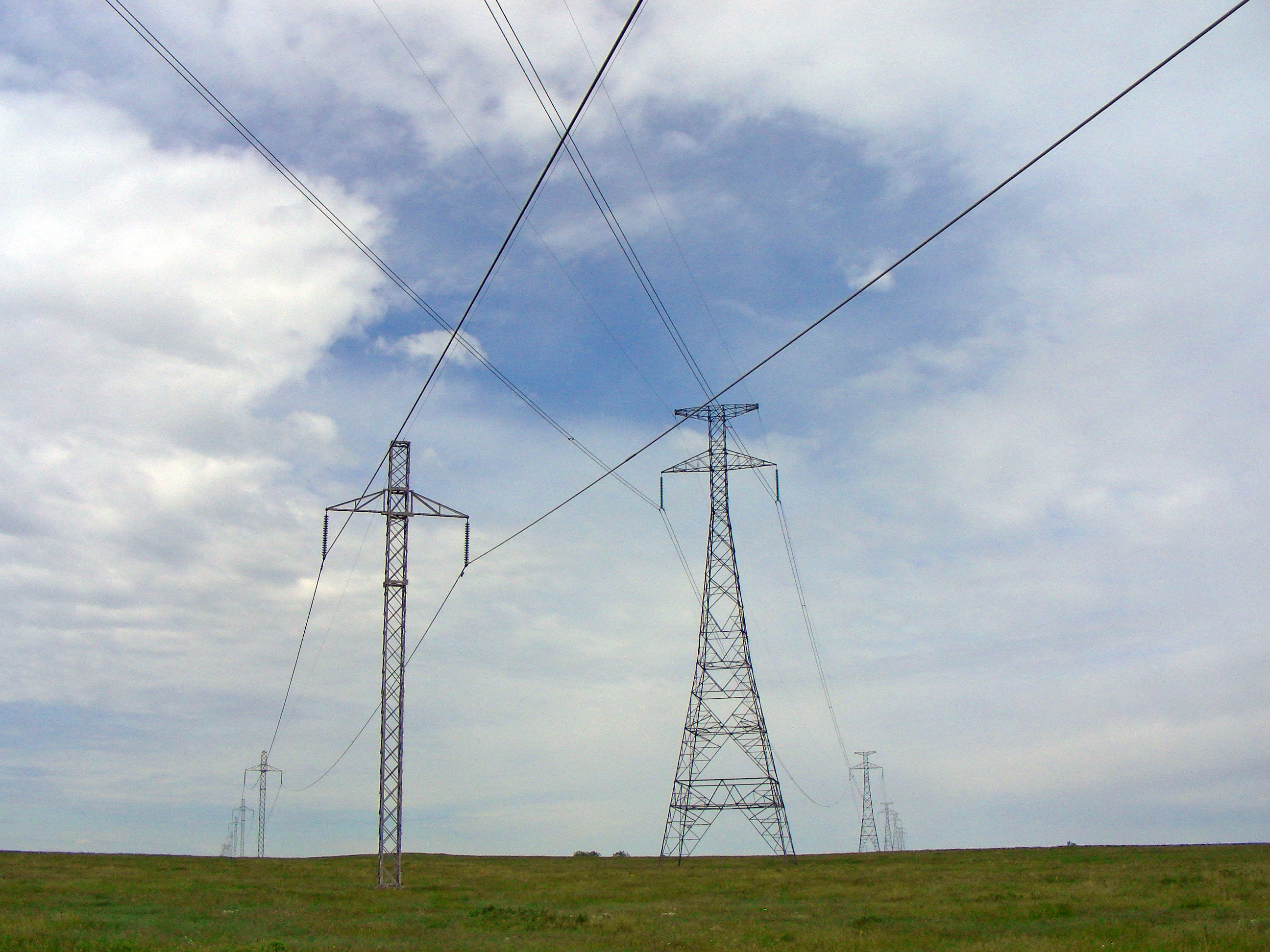
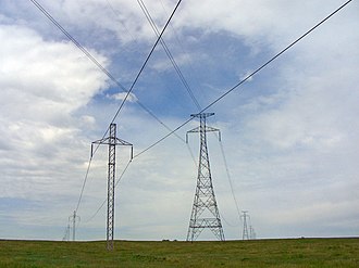
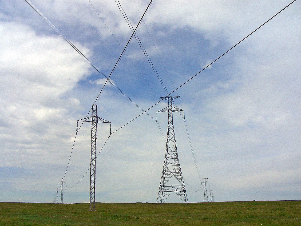
English: Crossing of HVDC transmission lines CU and Square Butte situated at 47d 2m 48s N, 100d 5m 49 s W, about 17.5 km south-east of Wing, North Dakota. Picture taken facing to the West in a mosquito-filled cow pasture June 2, 2010. Thanks to my very patient wife for spending the day driving out to the middle of nowhere for me to photograph this. Square Butte uses +/- 250 kV DC and single conductors per pole and is the line of towers on the left in this picture. CU uses +/- 400 kV, two conductors per pole and is the line of towers on the right. As far as known, this is the only crossing point of two HVDC overhead powerlines in North America. |
| Date | |
| Source | Own work |
| Author | Zonk43 |
| Object location | | View this and other nearby images on: OpenStreetMap |
|---|
Licensing
Wtshymanski, the copyright holder of this work, hereby publishes it under the following licenses:
This file is licensed under the Creative Commons Attribution-Share Alike 3.0 Unported license.
Attribution:
- You are free:
- to share – to copy, distribute and transmit the work
- to remix – to adapt the work
- Under the following conditions:
- attribution – You must give appropriate credit, provide a link to the license, and indicate if changes were made. You may do so in any reasonable manner, but not in any way that suggests the licensor endorses you or your use.
- share alike – If you remix, transform, or build upon the material, you must distribute your contributions under the same or compatible license as the original.

|
Permission is granted to copy, distribute and/or modify this document under the terms of the GNU Free Documentation License, Version 1.2 or any later version published by the Free Software Foundation; with no Invariant Sections, no Front-Cover Texts, and no Back-Cover Texts. A copy of the license is included in the section entitled GNU Free Documentation License. |
You may select the license of your choice.
Original upload log
The original description page was here. All following user names refer to en.wikipedia.
- 2010-06-03 02:21 Wtshymanski ({{Information |Description = Crossing of HVDC transmission lines CU and Square Butte situated at {{coord|47|2|48|N|100|5|49|W} about 17.5 km south-east of Wing, North Dakota. Picture taken in a mosquito-filled cow pasture Ju)
File history
Click on a date/time to view the file as it appeared at that time.
| Date/Time | Thumbnail | Dimensions | User | Comment | |
|---|---|---|---|---|---|
| current | 11:59, 24 January 2013 | | 2,592 × 1,944 (3.23 MB) | wikimediacommons>Amada44 | color cor |
File usage
The following page uses this file: